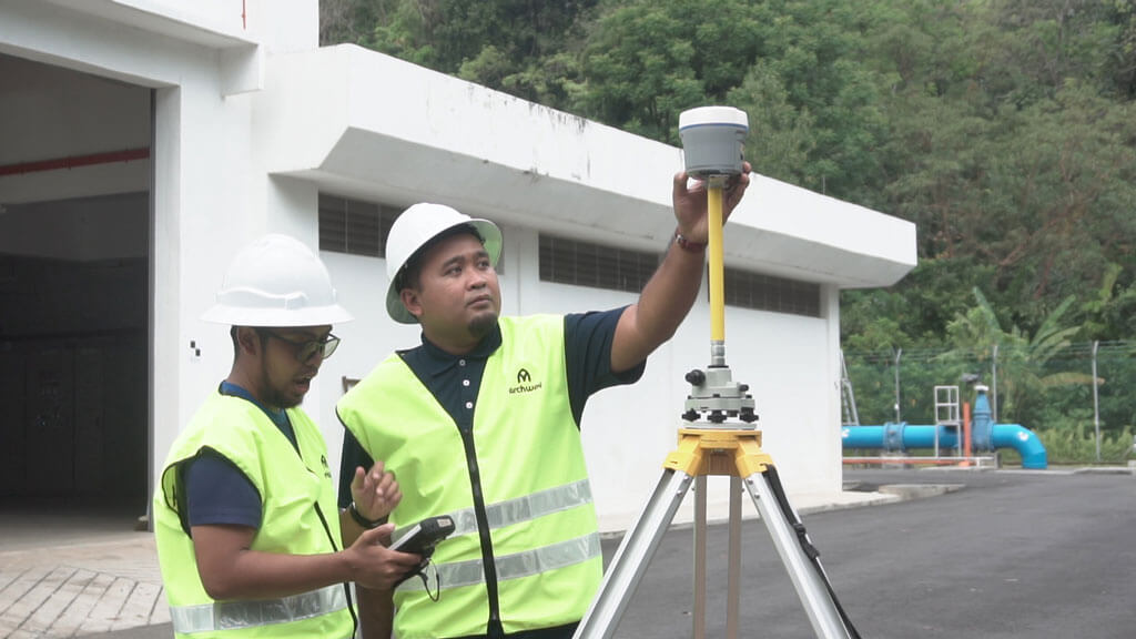
Topographical Survey
Topographical Survey is the work process to identify and map the contours of the ground and existing features on the surface of the earth or slightly above or below the earth’s surface (i.e. trees, buildings, streets, walkways, manholes, utility poles, retaining walls, etc.). The process is undertaken using equipment which include Global Positioning System (GPS), Total Station which are connected to Global Navigation Satellite System (GNSS) and Real Time Kinematic (RTK) which is maintained by the Malaysia Department of Survey and Mapping (JUPEM).
Engineering Survey
• Volume and Area of site
• Elevation
• Height Variation
• Highways and Road Alignment
• Road Deviation
• Earth Volume
• Tunnel Survey
• Dam Construction
• Monitoring Survey
Dimensional Control Survey
Dimensional control survey (DC survey) is a point to point survey using a high precision total station with an accuracy of +/- 1mm to measure existing structures or elements on site. The survey data is recorded in a 3D coordinate system. The survey data is processed using an advanced calculation software. This software allows surveyor to regenerate the control points on site to create a master control point system. Control points on site is determined by referencing to the structure or elements which is required by the client. Result from this survey will increase the accuracy during fabrication and reduce on-site error during installation. The software can directly generate the result for face of flange and bolt-hole rotation. Using this result, pipe spool can be corrected during fabrication to Client’s specification.
Hydrographic Survey
Hydrographic Survey is the science of measurement and description of features which affect maritime navigation, marine construction, dredging, offshore oil exploration/offshore oil drilling and related activities. It can also be used to locate and identify pipelines/cables which are located in rivers, lakes, streams etc.